

You can find on this page the Spain airports map to print and to download in PDF. The map of Spain airport presents details of location and international airports of Spain in Europe.

The Spain airports map shows location of airports in Spain. This airports map of Spain will allow you to determine which airport you will used to leave or arrive in Spain in Europe. The Spain international airports map is downloadable in PDF, printable and free.
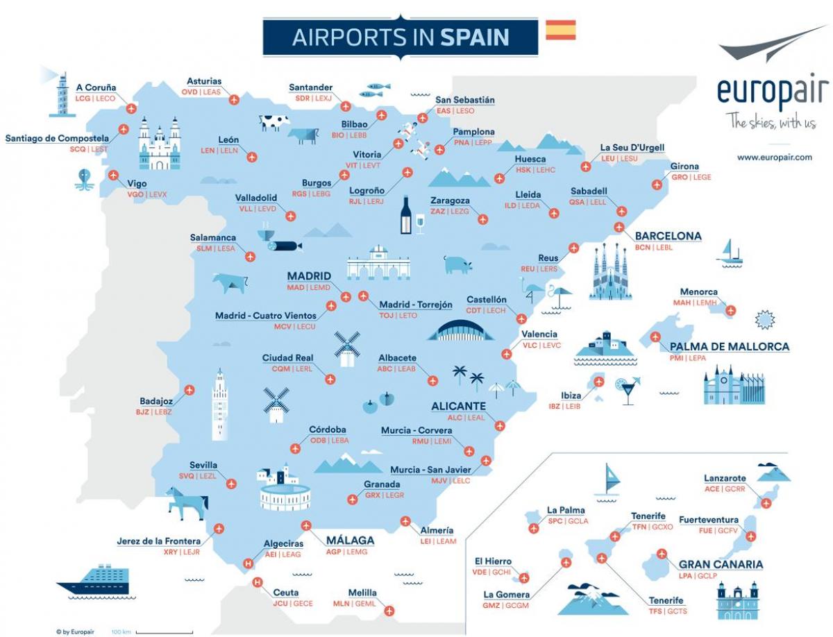
There are 47 public airports in Spain as its mentioned in the map of Spain airports. The busiest one is the airport of Madrid (Barajas), with 50 million passengers in 2011, being the world 15th busiest airport, as well as the European Union fourth busiest. The airport of Barcelona (El Prat) is also important, with 35 million passengers in 2011, being the world 31th busiest airport.
Other main airports are located in Majorca (23 million passengers) as youcan see in the map of Spain airports, Málaga (13 million passengers), Las Palmas (Gran Canaria) (11 million passengers), Alicante (10 million passengers) and smaller, with the number of passengers between 4 and 10 million, for example Tenerife (two airports), Valencia, Seville, Bilbao, Ibiza, Lanzarote, Fuerteventura. Also, more than 30 airports with the number of passengers below 4 million.
There are a large number of airports located throughout Spain and each one of the airports service various cities, regions and towns across Spain itself. Some major cities in Spain also have several smaller airports which are located close to them and which many passengers choose to use for various reasons as its shown in the map of Spain airports. These smaller airports (can be seen on a map of spain airports) that are located throughout Spain generally provide a much cheaper alternative to the main airports, due to the fact that many low cost airlines now fly into them.