

You can find on this page the Spain road map to print and to download in PDF. The Spain driving map presents the detailed road network, main highways and free motorways of Spain in Europe.
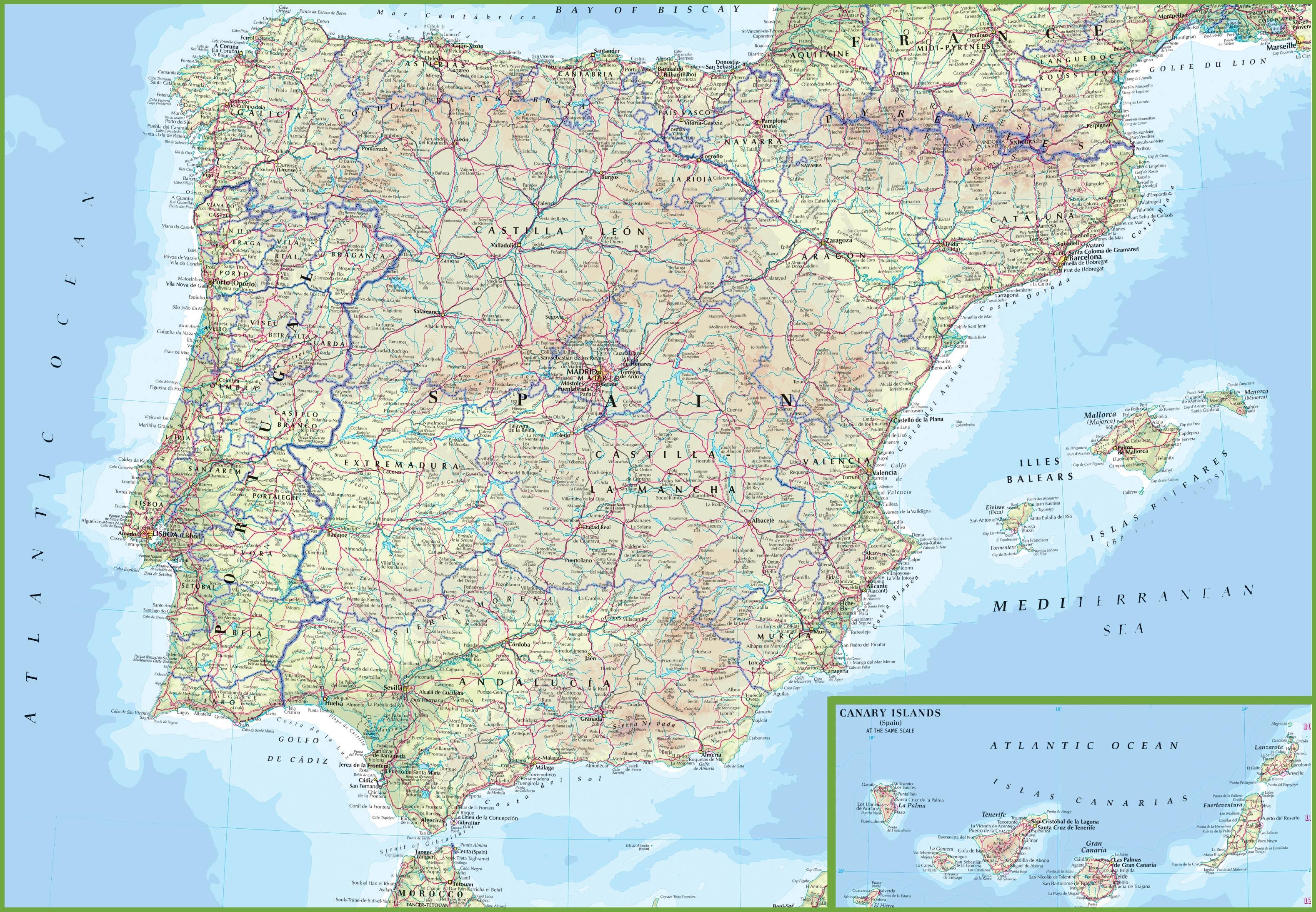
The Spain road map shows all roads network and main roads of Spain. This road map of Spain will allow you to preparing your routes and find your routes through the roads of Spain in Europe. The Spain roads map is downloadable in PDF, printable and free.
Most of the road network has only been constructed in the second half of the 20th century as its mentioned in Spain road map, primarily due to the efforts of the Spanish Socialists in the early 1980s. Nevertheless, despite the major restructuring of roads over the last 30 years, many complain that it is not sufficient for the greatly increased traffic, which is very heavy both on the highways and in cities.
In 2018, around 3.5 billion euros was invested in road transport infrastructure in Spain. The largest amount of money invested in road network infrastructure was in 2009, amounting to 9.4 billion euros as you can see in Spain road map. Although Spain infrastructure is similar to the rest of Western Europe, there is nevertheless an ongoing process of upgrading roads, airports, seaports, and railroads through public, private, and joint investment.
To use toll roads, drivers take a ticket on entering the toll road system and pay at an exit booth. Toll fees vary depending on the location and can be higher at peak times. Payment can be made in cash or by credit or debit card. When paying by card, drivers should use the exit marked “Vias Automaticas”. On major roads, orange-coloured emergency telephones are placed at 5 Km intervals. Different minimum and maximum speed limits are set according to different types of road as its shown in Spain road map. Speed limits may be lower on some roads and will be signposted.
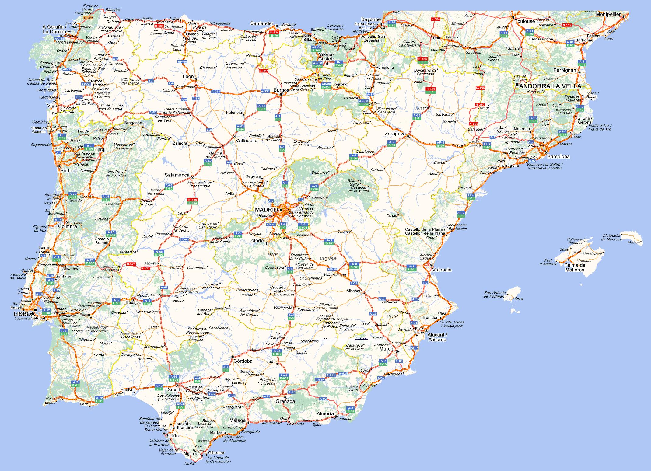
The Spain highway map shows toll and free motorways of Spain. This highways map of Spain will allow you to prepare your routes on motorways of Spain in Europe. The Spain highway map is downloadable in PDF, printable and free.
The Spanish road system is mainly centralized, with six highways connecting Madrid to the Basque Country, Catalonia, Valencia, West Andalusia, Extremadura and Galicia as its mentioned in Spain highway map. Additionally, there are highways along the Atlantic (Ferrol to Vigo), Cantabrian (Oviedo to San Sebastián) and Mediterranean (Girona to Cádiz) coasts.
The length of highways and expressways in Spain exceeds 17,000 kilometers as you can see in Spain highway map. Some of them are under the care of the National Road Network, and therefore these routes are managed by the General Directorate of Roads, i.e. de facto by the Spanish government. The highways in Spain are comfortable and safe, using them we can be sure that we will reach our destination quickly.
Expressways, also known as free highways because of their equally good quality. These roads are marked with the letter A (from the Spanish word autovía) as its shown in Spain highway map, and the appropriate number, also on a blue background. It is these routes that are a free alternative to traveling in Spain, because they often run parallel to the highways.