

You can find on this page the Spain population map to print and to download in PDF. The Spain population density map presents the number of inhabitants in relation to the country size and the structure of the population of Spain in Europe.
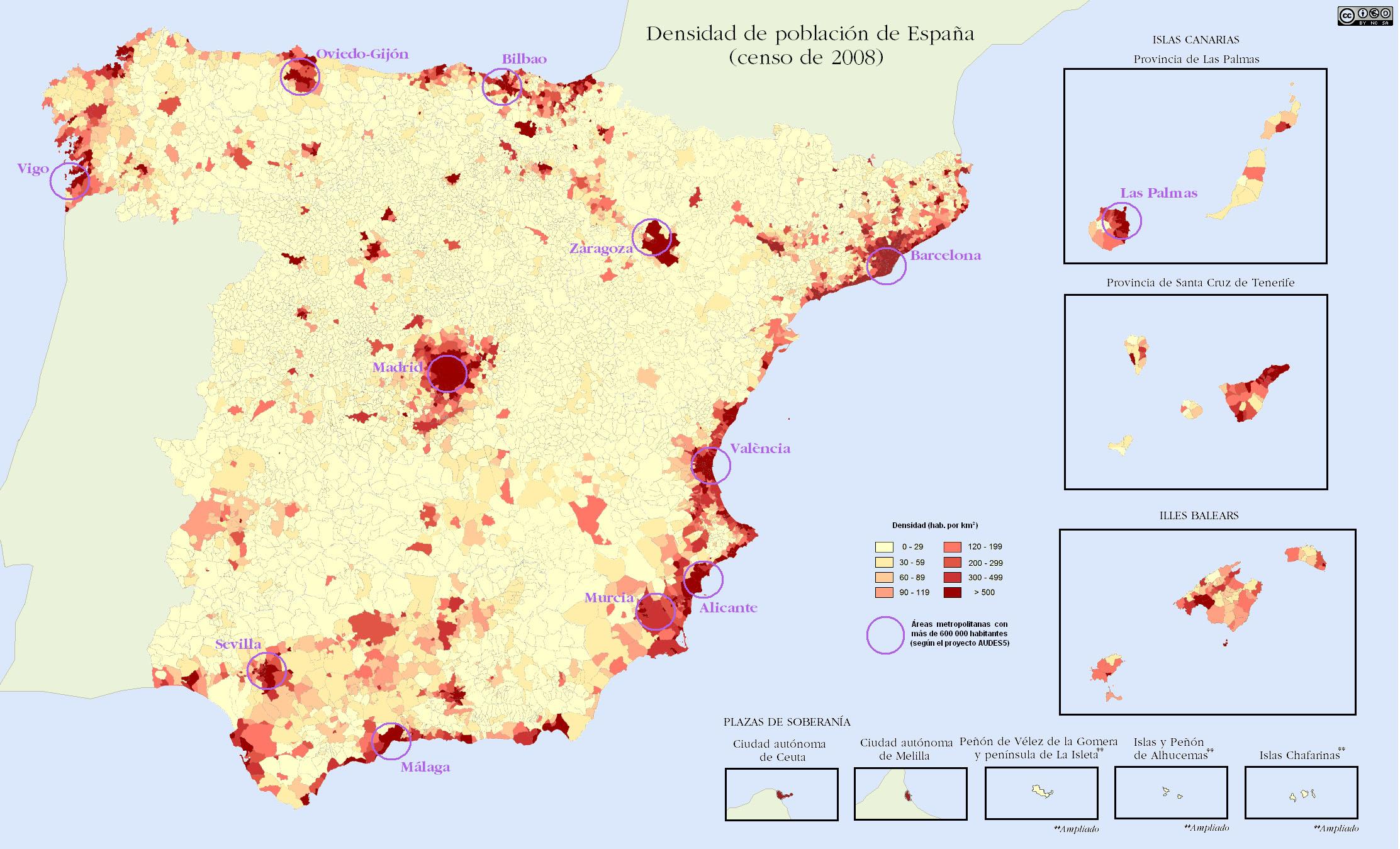
The Spain population density map shows the number of inhabitants in relation to Spain size. This demographic map of Spain will allow you to know demography and structure of the population of Spain in Europe. The Spain density map is downloadable in PDF, printable and free.
Spain ranks number 30 in the list of countries (and dependencies) by population. The population density in Spain is 94 per Km2 (243 people per mi2) as its mentioned in Spain population density map. The total land area is 498,800 Km2 (192,588 sq. miles). 80.3 % of the population is urban (37,543,537 people in 2020). The median age in Spain is 44.9 years.
The population density of Spain doubled during the twentieth century, but the pattern of growth was extremely uneven due to large-scale internal migration from the rural interior to the industrial cities, a phenomenon which happened later than in other Western European countries as you can see in Spain population density map. No fewer than eleven of Spain fifty provinces saw an absolute decline in population over the century.
Spain has 47,150,819 inhabitants according to 1/1/2010 municipal records (Padrón Municipal). Its population density, at 91.4/km² (229/sq. mile), is lower than that of most Western European countries as its shown in Spain population density map. With the exception of the capital, Madrid, the most densely populated areas lie around the coast.