

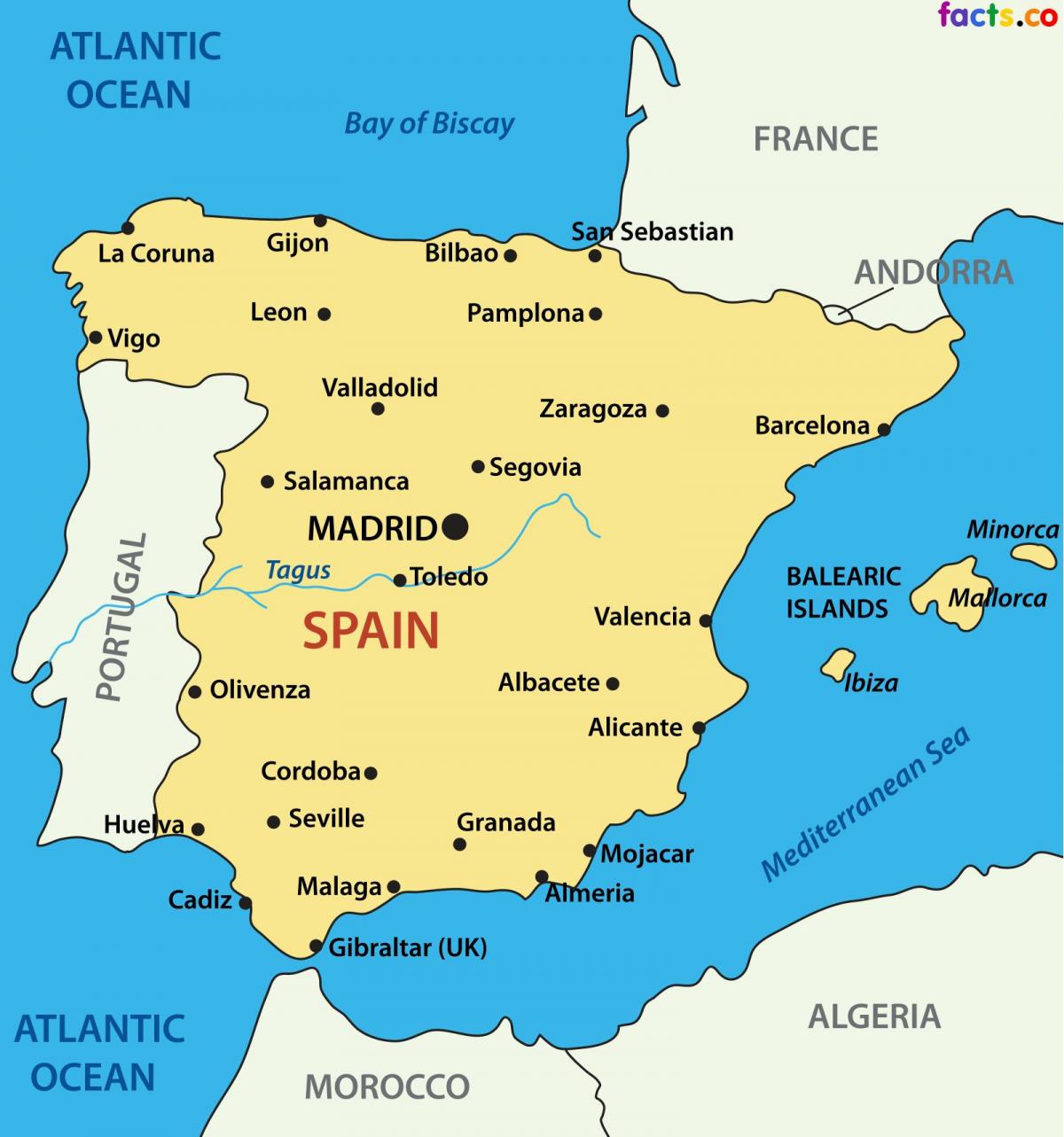
You can find on this page the Spain cities map to print and to download in PDF. The Spain map city presents main cities, towns and presents the capital of Spain in Europe.

The map of Spain with cities shows all big and medium towns of Spain. This map of cities of Spain will allow you to easily find the city where you want to travel in Spain in Europe. The Spain cities map is downloadable in PDF, printable and free.
The old city of Salamanca is a World Heritage site, known as Spain 'golden city', it enclaves a rich historical, cultural and gastronomical culture. Some of the main attractions are Plaza Mayor, the Roman Bridge and the Cathedral which offers spectacular views of the city. Bilbao is one of the best cities to visit in northern Spain, famous for being the art hub in the country. Do not miss the city iconic Guggenheim Bilbao Museum, one of architect Frank Gehry most impressive structures. One of Spain top cities with the perfect blend of culture, beach and gastronomy, Valencia is the ideal location for a city break as its mentioned in the map of Spain with cities. A city set in the mountains of east-central Spain and founded by the Moors, the hanging houses of Cuenca are an iconic symbol of the city.
Granada is one of the best cities to visit in southern Spain, home to one of the great wonders of the world, the Alhambra Palace as you can see in the map of Spain with cities. This special city offers the ultimate cultural weekend break, nestled beneath the Sierra Nevada mountains and only an hour from the Costa Tropical, you can combine a stay in the city with a beach excursion or even a day trip to the ski resort. Málaga city has become one of the most popular cities for a city break in Spain in recent years. Modern, attractive, full of museums and terraces with spectacular views. Toledo is a beautifully preserved city, with history at every corner. Set high in the hills of Castilla La Mancha in central Spain, the city is not as well known.
Ceuta and Melilla are called ciudades autónomas (autonomous cities) as its shown in the map of Spain with cities. Their status is in between regular cities and autonomous communities: on the one side, Ceuta and Melilla autonomous parliaments cannot enact "autonomous" laws, but, on the other side, they can enact regulations to execute laws, which are greater regulatory powers than those of regular city councils.
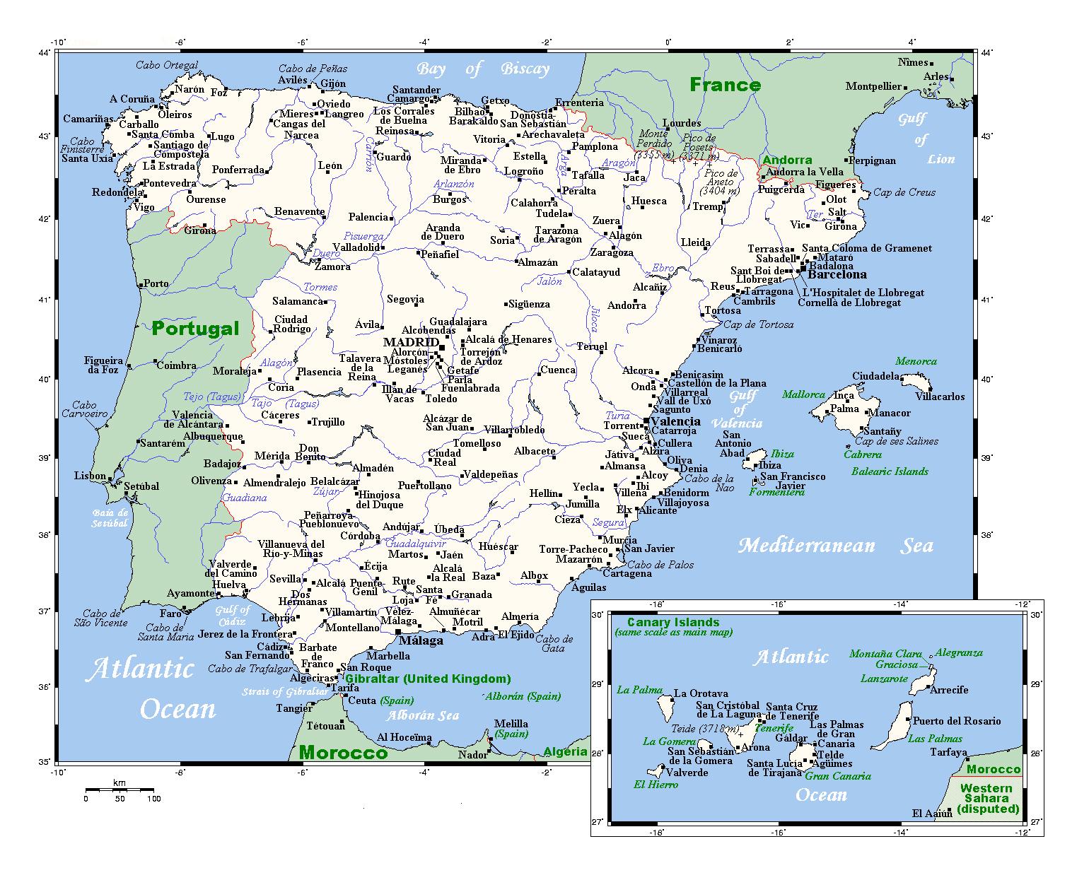
The map of Spain with major cities shows all biggest and main towns of Spain. This map of major cities of Spain will allow you to easily find the big city where you want to travel in Spain in Europe. The Spain major cities map is downloadable in PDF, printable and free.
Madrid is the capital city of Spain and by far the country largest city. Madrid is one of the most populated cities in Europe with 5,263,000 people. Barcelona is the capital city of the autonomous region of Catalonia and the second major city in the counry as a whole with 4,251,000 people. Valencia is the capital city of the autonomous region of Valencia and the third largest city in the country (1,499,000) as its mentioned in the map of Spain with major cities. Seville is the largest city in the autonomous community of Andalusia with 1,262,000 people. Bilbao is the largest city in Basque country, with nearly 1 million inhabitants.
Madrid and Barcelona are the only two cities in Spain that have populations exceeding one million as you can see in the map of Spain with major cities. However, that does not mean that there are not other major cities in the country. There are 88 countries that have populations that fall between 100,000 and 1,000,000, and an impressive 707 cities with populations exceeding 10,000. These cities are spread among Spain 50 provinces.
The total population of Spain is 46,733,038 as of 1-Jul-18 , which represents 0.61% of global population and ranks Spain # 30 worldwide. Spain has 2 major cities with more than a million people, 88 cities with between 100,000 and 1 million people, and 770 cities with between 10,000 and 100,000 people as its mentioned in the map of Spain with major cities. The largest city in Spain is Madrid, with a population of 3,255,944 people.

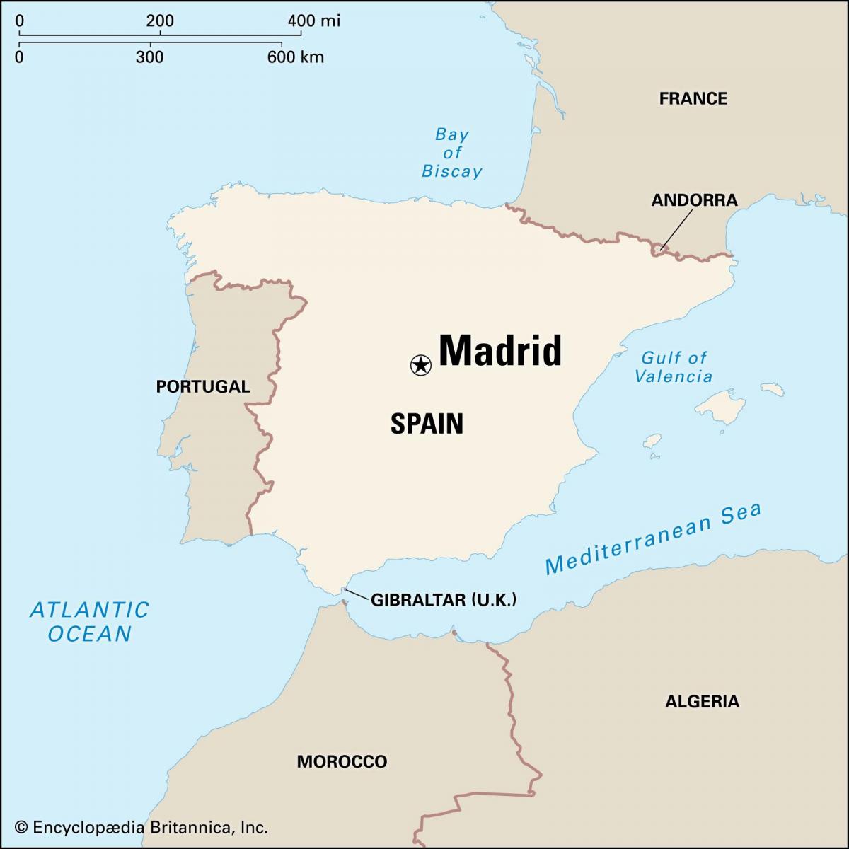
The capital of Spain map shows the main city of Spain. This capital map of Spain will allow you to easily plan your travel in the capital of the country Spain in Europe. The capital of Spain map is downloadable in PDF, printable and free.
A city of many names, Toledo is known as the “former capital of the Spanish Empire”, the City of Three Cultures and the Imperial City as you can see in the capital of Spain map. It was once the home of the Royal Court, and the largest multicultural metropolis the Empire had ever seen. Burgos is located in northern Spain and has been an important location in the country since the time of the Romans.
Madrid, formerly Magerit in Arabic and Matrit in Latin (often pronounced Madriz by locals). Formerly known colloquially as la Villa or the Town. Its coat of arms is a bear reaching to a strawberry tree and its flag a set of 7 white stars (four on top and three below) on a plain live red background. It has 6.5 million inhabitants the meteopolitan area, 4 million within the core of the city as its shown in the capital of Spain map. It is the residence of the prime minister, the king and all governement institutions.
Madrid, city, capital of Spain and of Madrid provincia (province). Madrid status as the national capital reflects the centralizing policy of the 16th-century Spanish king Philip II and his successors. The choice of Madrid, however, was also the result of the city previous obscurity and neutrality: it was chosen because it lacked ties with an established nonroyal power rather than because of any strategic, geographic, or economic considerations as its mentioned in the capital of Spain map.